
Brownsville Previous Residents Sources
The earlier household trail is layered. Cameron County deed indexes track legal parties and instruments, while city directories, census records, newspapers, cemetery material, permits, and maps capture different dates and different types of evidence. Start with the source closest to the period in question. The table separates what is known about coverage from what has not been confirmed, so a blank result does not become a claim that a person or a house was absent.
| Source | Years It Covers | Where Held | What It Shows |
|---|---|---|---|
| Cameron historic deed index books | 1830-1968; linked documents 1830-1957 | Cameron County Clerk Kofile portal | Grantor, grantee, book, volume, page, and older instrument trail |
| Current Official Public Records | Live index, certified through 2026-08-26 | Cameron County Clerk PublicSearch | Current recorded index; historical cutoff and full-image behavior not displayed |
| Deed-of-trust direct and reverse index | 1882-1892 | Texas State Library Cameron County microfilm | Trust and lien trail, not a complete deed run |
| Brownsville directories | 1913-1914 reference; 1966-1982 listed years | THC survey and Texas State Library | Name and address snapshots; local reverse run not confirmed |
| Federal census | 1850-1950 public release | NARA, Ancestry, FamilySearch, and BPL access | Household context on a census date |
| Brownsville permits and Sanborn maps | Permits 2015-2026; maps 1877, 1914, 1919, 1926, 1930, 1949 | City reports, LOC, UNT, and THC references | Work dates, footprint, lot context, and street geometry |
Use the oldest source only after the modern parcel is fixed. That reduces the risk of following a similar street number or a tax-mail address that belongs elsewhere. The current CAD card and city GIS map are starting tools, not a complete roster of occupants.
Brownsville Address Record Keys
A Brownsville house has several record identities. Save the street address as written, its GIS Address Point, the Cameron CAD PID or GEO ID, current situs address, tax mailing address, subdivision, lot and block, legal description, and a nearby intersection. Situs means the physical parcel location. Mailing means the destination for tax notices, which may be a post office box, another property, or another address. They are not interchangeable.
The Cameron County Appraisal District documents owner-name, address, PID, and GEO ID search modes. Its results can show ownership, property description, exemptions or special valuations, taxing units, and estimated tax-year amount. CAD does not issue deeds or plats. Use the property card to reach a legal description, then use the County Clerk for the recorded instrument or subdivision plat.
The Brownsville GIS map adds Address Points, County Parcels, Streets, intersections, City Limits, ZIP Codes, districts, and zoning layers. Its parcel shapes are approximate and are not survey or title proof. A map is the geographic bridge between a printed address and a parcel key.
Tracing Brownsville Previous Residents Backward
The deed trail begins with legal ownership, not a presumed occupant. Obtain the current owner and legal description from CAD, then use the Cameron County Official Public Records search for the purchase instrument. Search the owner as grantee, identify the seller or grantor, and search that seller as a prior grantee using the same legal description. A correction deed, probate filing, deed of trust, release, foreclosure, corporate party, replat, or merged tract can alter a simple-looking path.
- Record the current Brownsville situs address, PID or GEO ID, subdivision, lot and block, legal description, and owner name from CAD.
- Search the owner as grantee in the current public-records index, using a date range and the legal description to separate similar names.
- Copy the grantor, grantee, instrument type, recording date, document number or book and page, and any available image status.
- Search the prior seller as a grantee, again matching the legal description instead of relying on the street number alone.
- When the current trail reaches its limit, switch to the historic index books and then the appropriate TSL microfilm finding aid.
- Grantor
- The party conveying an interest in an instrument. In a routine sale, this is often the seller, but the document type controls the meaning.
- Grantee
- The party receiving an interest. Searching a grantee backward can identify the earlier transfer into that party's name.
- Chain of title
- The sequence of recorded interests tied by the same legal description. It is a legal-party trail, not a complete list of occupants.
- Legal description
- The lot, block, subdivision, metes-and-bounds, or other formal parcel description used to distinguish property when street labels shift.
Brownsville Historic Deed Records
Cameron's two deed routes serve different eras. The current PublicSearch Quick Search accepts a term, date range, index-only or index-and-OCR selection, and terms such as grantor or grantee, subdivision, document type, or document number. It displayed a certification date through 2026-08-26, but no single historical cutoff or complete image rule. Do not promise that an online result includes every older record or image.
The historic Kofile index exposes type, year, parties, last name, first name, book, volume, and page controls. Its index books cover 1830-1968, with linked documents noted for 1830-1957. The Texas State Library Cameron County microfilm guide also lists deed-of-trust direct and reverse indexes for 1882-1892. These access channels complement one another; none should be treated as the entire record system.
Open the Cameron historic grantor-grantee index to see the book and party controls used for the older Brownsville trail.
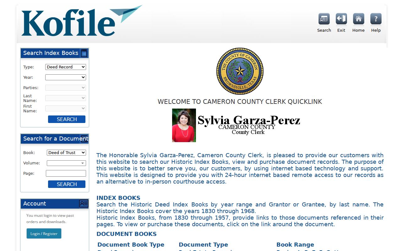
The historic form shows why a saved party role, year, book, volume, and page can be more useful than an unverified address string.
Note: An index row locates an instrument; it does not prove who lived at the Brownsville property on a later date.
Brownsville Directory Household Trail
Ownership is only one layer of a past-resident trail. The Texas Historical Commission survey cites a Brownsville City Directory for 1913-1914, and the TSL holdings list identifies later years from 1966 through 1982, including a separate 1978 Residential directory. A directory is a compiled address snapshot. It may name an occupant or household, but it should not be treated as a complete account of everyone at the location.
Search both sides of a volume whenever possible. The THC survey records a José Fernández address mismatch between Brownsville's alphabetical and street sections. Keep both entries, preserve accents and spelling, and test nearby numbers, street intersections, lot or block information, and a map sheet if the address does not carry across sources. Detailed shelf and entry-reading guidance is available in the Brownsville city directory collections.
Lawful use. Brownsville house-history research is appropriate for family history, estate matters, or personal curiosity. Do not use records to stalk, harass, or harm any living person.
Brownsville Census Record Pairing
Pair a directory with the closest public federal census instead of treating either source as a continuous timeline. Public census images and indexes currently reach 1950 under the 72-year release rule. The 1913-1914 directory fits between the 1910 and 1920 census. The 1966-1982 directory years come after the latest public census, so later continuity may require deeds, permits, newspaper notices, cemetery material, or a properly available vital or probate record.
- Start with a dated Brownsville directory entry and retain its exact name form, section, and address.
- Check the nearest public census for the household composition and birthplace context on its census date.
- Use a deed or CAD record to separate legal ownership from a printed household listing.
- Search the Brownsville Herald by name, address, place, and date for an announcement, obituary, civic notice, or event lead.
- Verify a relationship or death date through an appropriate cemetery, probate, or vital-record route before adding it to the trail.
The Brownsville Herald advanced search has text, AND/OR, people-and-places, city, title, and date controls. Its date range was not fully displayed during source inspection, so record the issue date actually found instead of assuming full publication coverage.
Brownsville Map and Permit Records
Sanborn maps date a place, not an occupant. Brownsville editions identified in the research include 1877, 1914, 1919, 1926, 1930, and 1949. The Library of Congress holds a digitized 15-sheet Brownsville edition from 1926 that can help test building footprint, lot context, street geometry, and physical use. Use it to explain an address change or a changed building, not to name a household.
City permit reports supply a later address chronology for 2015-2026. A public permit may expose application or issue date, work type, status, inspection events, and certain applicant or owner fields, but the exact Accela result schema was not verified. For earlier permit material, request a narrow address and date range under the Texas Public Information Act rather than assuming it is online.
Brownsville Historical Endpoint Records
A historical address trail can end in a newspaper notice, obituary, probate case, cemetery record, or vital index. Brownsville's local routes are distributed. The TSL Cameron guide lists cemetery records for 1839-1900, burial permits for 1870-1950 with a June 1938-through-1939 gap, Brownsville city birth transcriptions for 1914-1939, city death records for 1910-1977, and county civil minutes for 1867-1910. These records may be held on microfilm or through a custodian rather than a name-search web page.
The historical association may also have address-organized photographs, manuscripts, land grants, or property abstracts. Its request route requires an appointment and publishes a $25 preliminary search with a six-week response window. Ask for material by the exact Brownsville address, name variant, neighborhood, and date range already supported by the record log.
The TSL Cameron County microfilm coverage table identifies several local record runs that can fill a gap after the deed index.
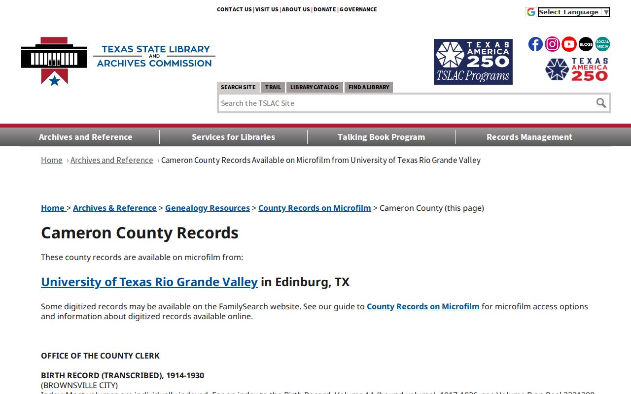
The microfilm table makes the coverage gap visible, including the stated burial-permit break, before a researcher draws a conclusion from a negative search.
Brownsville Address Record Gaps
Do not invent a Brownsville renumbering year. The research did not locate an official street-renaming or renumbering schedule, and the documented 1913-1914 directory conflict already proves that an exact-address search can fail. CAD's separate situs and mailing fields create a modern version of the same problem. The old printed address, current situs, mailing address, legal description, and PID can all be useful, but they are different identifiers.
When the trail breaks, test old street spelling, neighboring odd or even numbers, a nearby intersection, lot and block, predecessor tract, plat, Sanborn sheet, and historical city or county boundary. Ask the city planning office, a historic-directory custodian, or the Clerk for a verified crosswalk or record. Mark an unresolved connection as unresolved and preserve the source, date, reel, book, page, or portal controls used.