
Walk a Brownsville Street by Address
Street-level research works best as a chain of records. The City of Brownsville map supplies geography, not title evidence. Cameron County Appraisal District, often called CAD, supplies the current parcel record. The Cameron County Clerk holds the legal instruments. Voter information is more limited: VoteTexas is an identity-based registration check, not a public street roster. A printed directory or newspaper can add an older address lead, but neither proves present occupancy. Treat each result as dated evidence and preserve the source that produced it.
- Standardize the address, including directional prefix, street type, unit punctuation, old spelling, and nearby intersection when known.
- Open the Brownsville GIS map, turn on Address Points, County Parcels, Streets, and Street Intersections, then identify the target polygon.
- Save the parcel's PID or GEO ID, current situs address, subdivision, lot and block if shown, and the neighboring parcel context.
- Search that identifier or address at the Cameron County Appraisal District for ownership, mailing and situs fields, exemptions, taxing units, and estimated tax information.
- Use the owner and legal description in the Cameron County Clerk current records index, then follow recorded party roles and document references backward when the instrument supports it.
- For a dated household lead, compare the relevant street section in a historical directory, a Sanborn sheet, or the Brownsville Herald rather than treating a current parcel card as a full resident list.
That order avoids a common mistake: an owner name on a parcel card is a property connection, while an address in a directory is a compiled entry for a particular period. Neither alone identifies every person at an address.
Brownsville CAD Address Search Fields
CAD documents four ways to find a property record: PID number, GEO ID number, address, and owner name. Use the physical or situs address for a street search. The public portal did not expose a verified ZIP filter, export control, sort control, or partial-match syntax during the research inspection, so a by-address search should not promise a one-click list for an entire road. GIS first, followed by one CAD search for each PID or GEO ID, is the documented route.
| CAD field or mode | Type | Required | Known use |
|---|---|---|---|
| PID# | Text identifier | No, one search mode | CAD account or property identifier; exact format is not stated. |
| GEO ID# | Text identifier | No, one search mode | Geographic identifier; exact format is not stated. |
| Address | Text address | No, one search mode | Use the situs or property address. |
| Owner name | Text name | No, one search mode | Owner-name search is confirmed; exact name syntax is not stated. |
| Portal filters | Dynamic controls | Not exposed | ZIP, result-limit, export, and sort behavior were not verified. |
The resulting parcel record can show a property description, ownership, exemptions or special valuations, taxing units, and estimated tax-year amount. CAD does not issue a physical address, deed, or subdivision plat. The County Clerk is the proper source for a plat, legal instrument, or recorded ownership document.
A Cameron CAD property-search portal capture shows the public entry point used in this Brownsville street directory workflow.
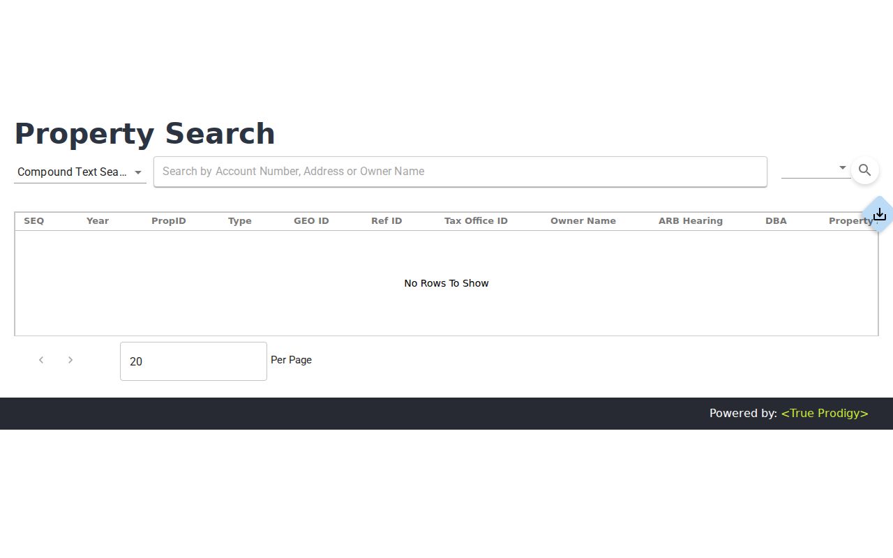
The portal image is a starting screen, not proof of a particular field or result. Keep the PID or GEO ID with the source date before moving to a deed search.
Browse Brownsville Parcels in GIS
The One City Interactive Web Map provides the visual part of a Brownsville by-address search. Its documented layers include Address Points, County Parcels, City Limits, Streets, Street Intersections, ZIP Codes, Electoral Districts, Planning and Zoning, Brownsville Metro, parks, schools, public safety, and facilities. Turn on only the layers needed for the question, then pan along the street and compare the target polygon with adjoining parcels. The map is especially helpful when a printed address is ambiguous or a street name may have changed.
Map boundaries are approximate and are not a survey, legal, engineering, or title product. The research did not verify a dynamic popup field list, radius function, buffer tool, or export option. A polygon that looks adjacent should therefore be checked against CAD and, where a boundary matters, a recorded plat or clerk instrument. The GIS view tells you where to investigate. It does not settle ownership by itself.
Note: Keep the active layers, map date, target address, and parcel identifier together so a later reader can reproduce the Brownsville street search.
Brownsville Address Records on File
Several address-keyed sources can describe a Brownsville street, but their fields are not interchangeable. CAD is the current property connection. The deed index is a party-and-instrument trail. GIS supplies parcel shape and surrounding geography. Permit reports place work at a site. Historical directories and Sanborn sheets place a name or structure at a documented time. The table separates those uses so an owner, occupant, permit applicant, and map label are not silently treated as the same fact.
| Address record | Custodian | Street-level value | Access route |
|---|---|---|---|
| CAD property card | Cameron County Appraisal District | Current owner, situs and mailing address, PID/GEO ID, legal description, values, taxing units, and exemptions. | Property portal, FAQ, or written open-records request. |
| Parcel and address layers | City of Brownsville GIS | Approximate adjacency, address points, ZIP, city limit, zoning, districts, and streets. | Public One City map. |
| Recorded instruments | Cameron County Clerk | Grantor/grantee, instrument type, recording date, and document or book-page reference. | Current PublicSearch; historic Kofile books. |
| Permit reports | Brownsville Building Permits and Inspections | Address-based work chronology and public fields where available. | Reports for 2015 through 2026; request older records. |
| Historical directories and maps | TSL, BPL, BHA, and map repositories | Printed address entries and building or street context for a defined period. | Library, archive, microfilm, and digitized collections. |
The Cameron County Tax Assessor-Collector also has real-time account search and weekly refreshed delinquent files, but it is not a substitute for CAD's property facts. When a city record is missing online, a targeted written request under the Texas Public Information Act should name the custodian, address, date range, and desired record.
Brownsville Deed Chains by Street
Move from a current parcel to recorded ownership through the legal description, not an assumed address-only deed search. Record the CAD owner, PID or GEO ID, subdivision, lot and block, and situs address. In the current Official Public Records search, look for the owner as grantee and narrow by date. Log each party's role, instrument type, recording date, document number or book and page, legal description, and image status. Then search a seller or grantor as a prior grantee while holding to the same legal description.
More complex chains require care. A replat, merge, subdivision, metes-and-bounds description, correction deed, deed of trust, release, probate event, foreclosure, or entity can change the apparent path. A lien instrument is not evidence that someone moved in or out. For older material, the Cameron historic index supplies Type, Year, Parties, Last Name, First Name, Book, Volume, and Page controls. It covers index books from 1830 through 1968, with linked documents noted through 1957. TSL also lists deed-of-trust direct and reverse indexes for 1882 through 1892.
The current Cameron County records search displays a Quick Search with a term field, date range, quick date choices, and index-only or index-and-full-text OCR choices. Its certification notice was displayed through August 26, 2026 during research. That date identifies the notice, not a promise that every older image is online.
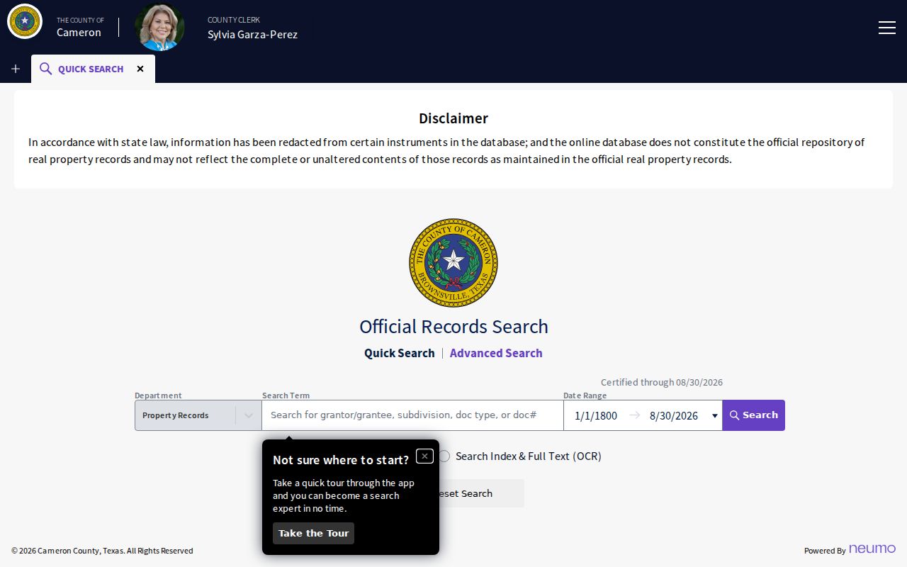
The indexed fields shown in the search screen support a party-and-document trail after an address has been tied to a parcel. Verify an instrument with the Clerk before relying on it.
Brownsville Historic Street Entries
Past Brownsville street research needs more than a current map. Texas State Library holdings include Brownsville directories for 1966, 1968, 1970, 1971, 1973, 1978, 1978 Residential, and 1982. A Texas Historical Commission survey also cites a 1913-1914 Brownsville City Directory. That survey found a José Fernández address conflict between the alphabetical and street sections. It is a local warning to compare both sides of a printed directory rather than treating either as error-free.
No complete official Brownsville reverse or criss-cross directory run was located. Use the library's catalog and staff, the Texas State Library directory lead, Brownsville Herald advanced search, Sanborn sheets, GIS address points, CAD identifiers, the deed index, and Brownsville Historical Association address-organized photographs as a cross-source stack. The historical collection itself belongs with the Brownsville city directory research, while the useful street question here is whether a dated source links an address to an occupant or structure.
Sanborn editions identified for Brownsville include 1877, 1914, 1919, 1926, 1930, and 1949. They can describe building footprint, use, street geometry, and lot context, not a complete list of people. Preserve accents, compound surnames, maiden names, initials, and Spanish or Anglicized variants in notes.
Brownsville Permit Reports by Address
The city's Building Permits and Inspections Division adds a physical timeline to an address trail. Downloadable permit reports cover 2015 through 2026. The online route leads to Accela Citizen Access, but the research could not verify guest search fields, public result limits, or its older coverage. A permit may provide project dates and address-related context where public, yet it is not a resident record or proof that a named person lived there.
For earlier material, request a specific address and date range from Building Permits and Inspections under the Texas Public Information Act. City code-enforcement and complaint information should be requested just as narrowly because a complete public citywide search form was not verified. Keep permit date, status, record type, and source alongside the address. That makes the source useful without claiming more than its public fields establish.
Brownsville Address Search Keys
One Brownsville address can have several usable identities. CAD separates a property's situs address from the mailing address used for tax notices. GIS separates City Limits from ZIP Codes. The Clerk's historic index uses party names, type, year, book, volume, and page. Preserve the old printed address, current situs address, mailing address, legal description, and PID or GEO ID when following a difficult street trail.
- Parcel
- A defined piece of land used by CAD and GIS to connect an address with property records.
- Situs address
- The physical location of the parcel, which can differ from the tax-notice mailing address.
- Legal description
- The title description of land, such as a subdivision lot and block or metes-and-bounds description.
- Plat
- A recorded map of a subdivision or tract; CAD directs researchers to the County Clerk for plats.
- Criss-cross directory
- A reverse-style printed directory arranged around addresses; no complete official Brownsville run was located.
Note: A mailing field can lead away from the parcel, so label it as correspondence data instead of treating it as a second residence.
Brownsville Address Search Limits
A public property or deed result does not enumerate every household member or establish current occupancy. GIS identifies approximate geography. CAD identifies property and account information. A deed identifies parties to a recorded instrument. VoteTexas can confirm one person through its permitted identity modes, but it is not a public whole-street or ZIP roster. The Secretary of State voter-file request is a different process with a deposit, affidavit, delivery rules, and use restrictions.
Utility customers, delivery recipients, unlisted phone numbers, ordinary driver-license addresses, and protected voter addresses are not ordinary public address fields. Texas Address Confidentiality Program participants may use a substitute address, and confidential categories can limit voter information. A blank result is a coverage question, not a reason to reconstruct a protected person's location from nearby records.
Lawful personal use. Brownsville address records can support family history, property research, civic questions, and personal reconnection. Do not use a street search to stalk, harass, intimidate, or harm anyone.
Brownsville Address Record Gaps
Brownsville's record trail is divided among live portals, clerk books, microfilm, city offices, libraries, and Brownsville Historical Association collections. The key gap is not a documented courthouse-loss event. It is the distance between a record that survives and a record that is searchable online. Historic Kofile index books reach 1830 through 1968, while current PublicSearch is a separate live system. Older deeds, printed address evidence, and maps may require a book, reel, counter, or collection request.
When a name or number fails, log the exact search, source, date, old address form, parcel key, legal description, and nearby intersection. Compare the 1913-1914 alphabetical and street sections, then test a plat or Sanborn sheet where needed. That evidence trail is stronger than silently assuming a person disappeared or an address never existed.